Thank you for choosing Mapinr! In today's fast-paced world, keeping up with the rapid evolution of Android versions can be challenging, especially for non-profit projects like ours. However, our commitment remains unwavering—to deliver a secure, privacy-focused, and affordable app that aligns with our vision.
We understand that Google's requirements for a minimum Android version can exclude many devices. To address this, we provide downloads for versions below Android 14, which are no longer supported by the Play Store, directly on our website.
Are you looking to manage your own points of interest or perhaps add your photos to a map? MAPinr is the solution you need. This straightforward, ad-free Android app is designed to handle your kml/kmz files and display your gpx files across various maps. Whether you're a professional or an enthusiast in hiking, cycling, running, skiing, and more, MAPinr caters to your needs.
We value your feedback and ideas for enhancing MAPinr. Please share your thoughts and suggestions with us at [email protected]. While we appreciate your patience with any software bugs or missing features, remember that our resources are limited. We welcome constructive feedback rather than criticism.
Here’s what MAPinr offers:
- Ad-Free Experience: Enjoy an app free of advertisements.
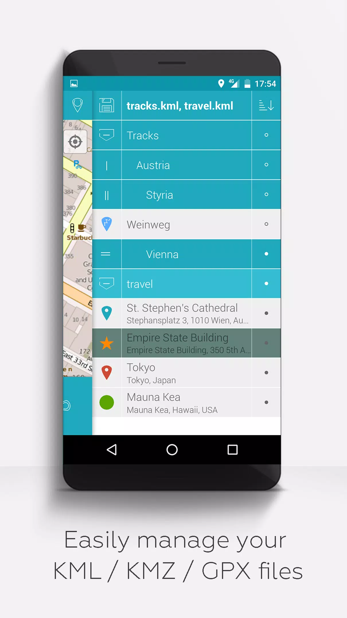
- Organized File Management: Utilize a hierarchical folder structure to manage multiple kml/kmz/gpx files.
- Comprehensive KML/KMZ Handling: Create, load, edit, save, import, export, and share kml/kmz files effortlessly.
- Waypoint, Line/Track, and Polygon Management: Perform the same operations on waypoints, lines/tracks, and polygons.
- Photomaps: Add pictures to waypoints to create personalized photomaps.
- Versatile Map Display: View your waypoints, lines/tracks, and polygons on various maps, including Maps, Satellite, Hybrid, OpenStreetMap, Opentopomap, and Opencyclemap.
- Coordinate Sharing: Easily share the coordinates of your waypoints.
- Custom Colorization: Individually colorize waypoints, lines/tracks, and polygons for better visualization.
- Inter-App Compatibility: Open exported kml/kmz files in other apps.
- Advanced Search: Search by name, address, and coordinates.
- Location Sharing: Share your location with friends.
- Simultaneous Display: Show multiple kml/kmz/gpx files at the same time.
- File Merging: Merge kml/kmz files for easier management.
- Cloud Integration: Seamlessly integrate with cloud services.
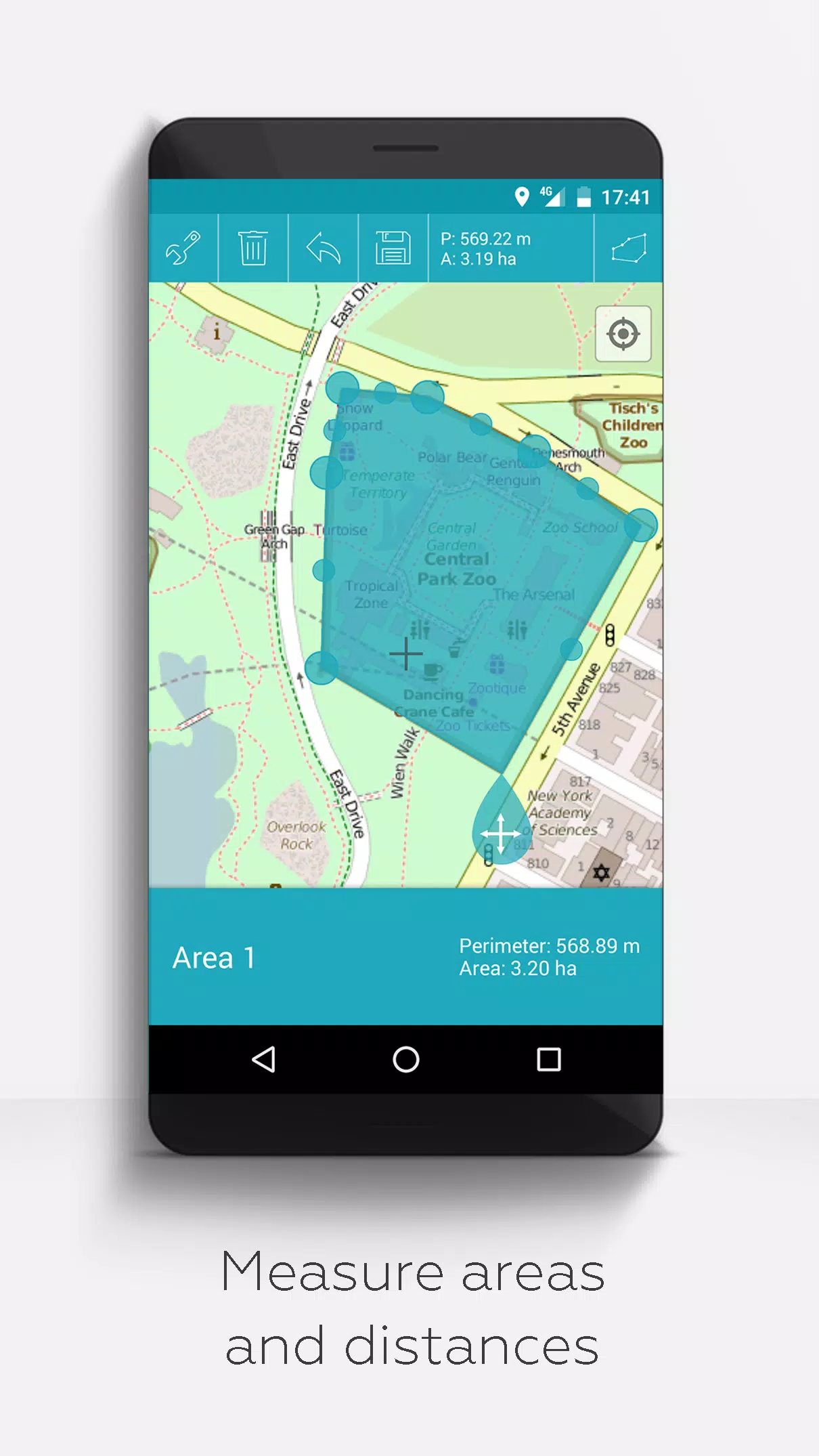
- Measurement Tools: Measure distances and areas directly on your map.
- Multilingual Support: Available in English, Spanish, Lithuanian, and Polish.
For those who wish to unlock additional features, consider making a donation or liking us on LinkedIn. These extended features can be activated in the Settings and include:
- Offline Maps: Download OpenStreetMap for free to use offline.
- GPX Viewer: Display GPX files.
- Web Map Service (WMS): View arbitrary map data, such as from www.data.gov.
- Custom Metadata: Create custom metadata for your files.
- Custom Icons: Upload and use your own icons.
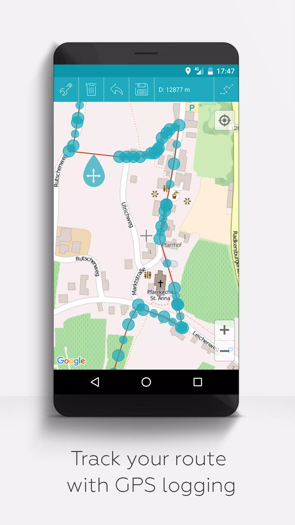
- GPS Tracking: Record GPS tracks during your activities.
Unlike other apps, MAPinr respects your privacy and does not collect or sell your personal data. Your donations support our non-profit efforts and are greatly appreciated.